Listen to this note:
High temperatures in the Bay Area will not continue until Monday night, but for meteorologists at the National Weather Service, there is a light at the end of the tunnel, as temperatures will begin to cool off starting Tuesday.
?Okay, folks. There is light at the end of the tunnel. We're tired, too, but we have some good news. All excessive heat warnings have been downgraded to heat advisories (as of 11 p.m. today) and the coastal heat advisory is no longer in effect. We can do this!? the agency said in a statement. publication of X.

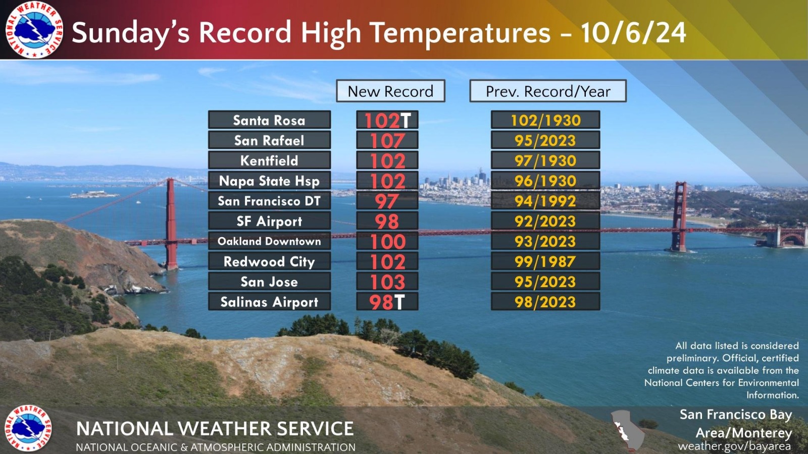
Heat records were matched or broken Sunday in the Bay Area and beyond, surpassing temperatures from a heat wave that struck nearly 100 years ago, according to the weather service.
According to the weather service, Redwood City experienced temperatures as high as 102° F on Oct. 6, three degrees higher than its highest recorded temperature of 99° F in 1987.
San Jose recorded 103°F, its previous record was 95°F in 2023; San Francisco International Airport had a new record of 98°F, while its previous record was 92°F in 2023.
The highest temperature recorded was in San Rafael, with a maximum of 107°F, 12 degrees higher than its previous record (95°F), in 2023.

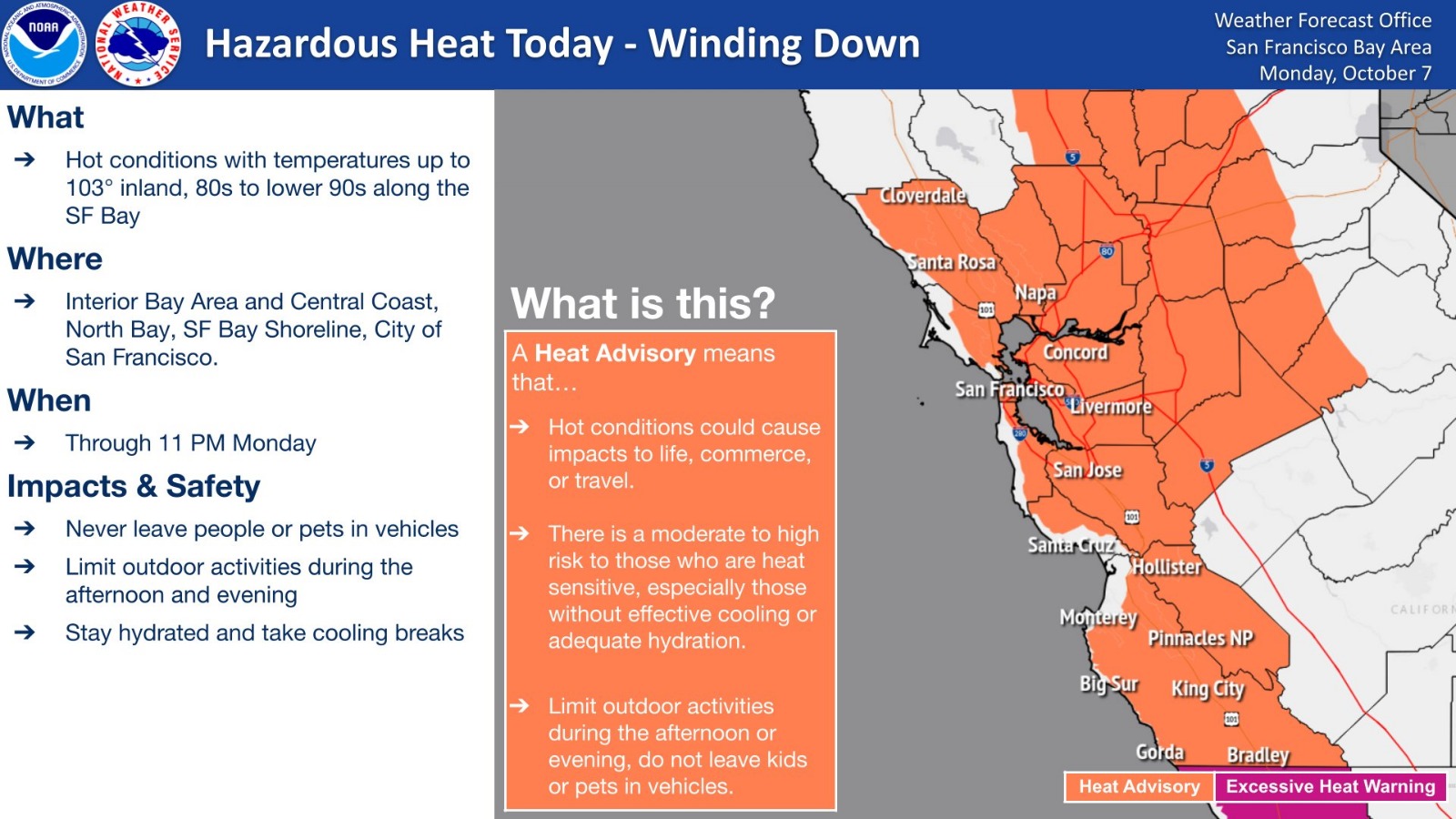
It will still be warm enough Monday to warrant a moderate to significant heat risk warning for some areas away from the coast, such as the inland East Bay, Santa Cruz Mountains, North Bay Mountains and eastern Santa Clara Hills, according to the National Weather Service.
Daytime highs on Monday will be in the 70s and 80s along the coast, in the 80s and 100s around the bay and in the 90s and 100s inland. Overnight lows will be in the 50s, with some areas dipping into the 60s.
Temperatures are expected to drop Monday night as land flow is restored, the agency said, while reminding people and pets not to be left unattended in cars or outdoors during heat waves.
With information from Bay City News.
You may be interested in: Tips for staying cool in the predicted heat wave for the Inner Bay Area

