

Sunday's dry spell helped the Bay Area recover briefly from a powerful storm on New Year's weekend, but a Pineapple Express, a term forecasters use to describe a flow of moisture from areas just north of Hawaii directly to the Pacific Northwest that is often accompanied by heavy rain, and is on its way to the area, will spawn a midweek storm in the Bay Area, forecasters said Monday.
With that, cleanup efforts to salvage flooded basements and clear mudslides from highways will be halted by the atmospheric phenomenon, which will hit late Tuesday through early Wednesday morning.
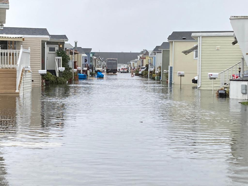
Grounds already saturated from last weekend's downpours will only intensify the impacts of the new storm, which this time will be accompanied by strong winds, the National Weather Service for San Francisco and the Bay Area said.
The latest system could bring a repeat of the recent flooding and the National Weather Service urges residents to prepare for rising creeks, falling trees, mudslides and power outages.
Notably, most areas will see light showers starting Monday afternoon and evening, setting the stage for the big storm, according to the National Weather Service.
The downpours will be heaviest from Wednesday afternoon until early Thursday morning and will be accompanied by strong winds. Scattered showers are expected to continue from Thursday into early Friday morning.
The weather service said totals as of Tuesday night are expected to reach 4.5 to 6.5 inches in the Santa Lucia Mountains and the Big Sur coast.
The coastal mountains in the North Bay are forecast for 4.5 to 6.5 inches, and the Santa Cruz Mountains and northern Monterey Bay will see 3.5 to 6 inches.
The interior of the North Bay is expected to get 2.75 to 5 inches. San Francisco, along with the East Bay and South Bay areas, are forecast to be 1.5 to 3 inches.
The southern and eastern Monterey Bay are expected to see 2 to 3 inches and the Salinas Valley/San Benito County area 1.5 to 3 inches.
During the latest storm, San Francisco had its second wettest day on record, when the city received 5.46 inches of rain on December 31, just shy of the all-time record of 5.54 inches of rain set on November 5, 1994, according to Jan Null, a certified meteorologist with Golden Gate Weather Services.
That brought San Francisco's December total to 11.60 inches, the wettest December 15 on record for the city, which has held a rainfall record since 1849.
With information from Bay City News.
You may be interested in: San Mateo County issues recommendations for those returning to flooded areas
